Surface Topography
SurfATT requires a surface topography file in the format of netcdf with the same format as the file generated by the GMT software. Thus, the surface topography file can be generated by the gmt grdcut the following command:
gmt grdcut @earth_relief_01m -R-157/-152/18/21 -Ghawaii.ncThe above command generates a surface topography file hawaii.nc with the region -R-157/-152/18/21 from the earth_relief_01m dataset. The earth_relief_01m dataset can be downloaded from the GMT website here .
Rotate coordinates of topography
The topography file generated by the gmt grdcut command is in the geographical coordinate system. To rotate the topography file to the model coordinate system, the SURFATT_rotate_topo command can be used. The following command rotates the topography file hawaii.nc to the model coordinate system:
pos_str=19.5/-155.5
angle=-30

SURFATT_rotate_topo -i hawaii.nc -a $angle -c $pos_str -x -0.75/0.8 -y -0.75/1 -o hawaii_rotated.nc
The pos_str is the center of rotation in latitude and longitude, and the angle is the rotation angle in degrees. The -x and -y options specify the range of the longitude and latitude axes in the model coordinate system. The rotated topography file is written to the output file hawaii_rotated.nc.
Both are required, and are given in degrees in the rotated frame, can read them off the rotated source–receiver file. They must cover the whole model domain, otherwise the inversion aborts with Model grid extends beyond topography bounds.
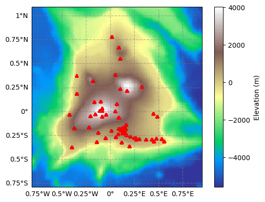
The rotated topography file hawaii_rotated.nc can be used as the input parameter topo_file in the SurfATT package for the inversion.